The proposed trail will connect existing recreation features at Randolph Recreation Grounds with a fully accessible route.
Town/Region: Randolph, Vermont
Website: https://randolphvt.myrec.com/info/default.aspx
Trail Snapshot
| Length | Surface | Width |
|---|---|---|
| ~1.2 miles (to be built in 4 phases) | Crushed ledgestone base with hardpack surface | 5 feet (average) |
| Grade | Cross Slope | Use |
|---|---|---|
| ~5% average, max 12% in intervals | 2-3% | Pedestrian, wheelchair-accessible, recreation access to facilities |
| Parking & Restrooms | Trail Standards | Trail Map |
|---|---|---|
| Lots to be updated on School Street and Park Street; both require regrading and ADA spaces. Restrooms to be relocated/added near accessible parking and trailheads. | Access Board Guidelines | Draft map |
About the Trail
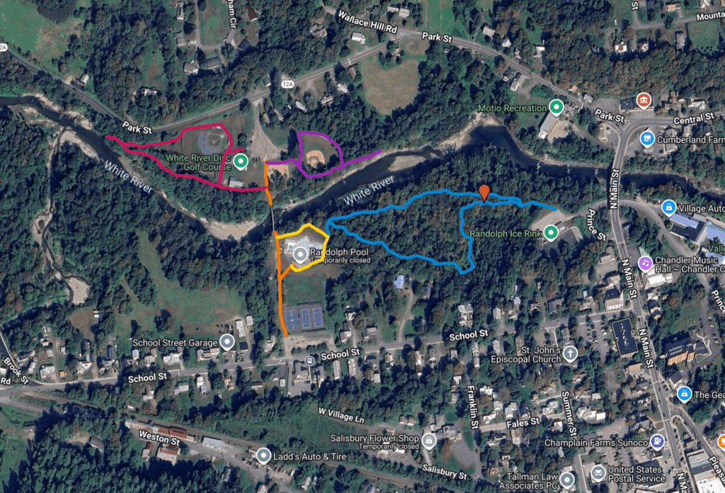
The proposed trail will connect existing recreation features at the Randolph Recreation Grounds with a fully accessible route. Once complete, the trail will create loops and spurs linking parking areas, courts, the pool, ice rink, playground, and fields. The project will improve inclusivity for residents and visitors while making the grounds safer and easier to navigate.

How the Trail Concept Came to Life
In July 2025, the Randolph Recreation Department partnered with Upper Valley Trails Alliance (UVTA) to assess opportunities for accessible trails at the Recreation Grounds.
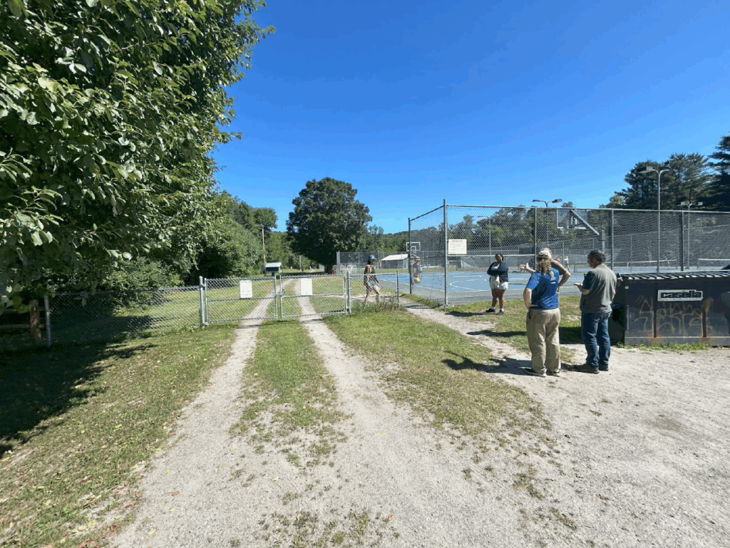
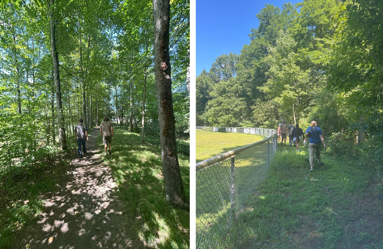
UVTA staff and town partners walked the site and developed a phased plan to build trails that meet federal accessibility guidelines. The assessment emphasized sustainable construction, integration with existing recreation facilities, and phased implementation to match funding availability.
The project builds on Randolph’s investment in community recreation and connects to broader statewide efforts through the Vermont Trail Accessibility Hub. The site will serve as a model for inclusive trail development in Vermont.
View the Completed Trail Assessment

Partners
- Randolph Recreation Department
- Vermont Law School Albert Schweitzer Fellow
- Vermont Trail Accessibility Hub partners:
- Vermont Trails & Greenways Council
- Upper Valley Trails Alliance
Funding
Grant funding for the trail assessment: Vermont Trail Accessibility Hub
Town of Randolph
Potential volunteer and donated labor/materials to offset costs
Design Highlights
- Phased Build: Four connected trail sections totaling over a mile, linking parking, pool, ice rink, playground, courts, and fields
- Surface Materials: Crushed ledgestone + hardpack with geotextile for durability and vegetation control
- Accessibility Features: Wheelchair access to recreation facilities, benches, and picnic areas
- Bridge Upgrade Needed: 121-foot White River bridge requires new decking for long-term accessibility
- Parking Integration: ADA-designated spaces and accessible restrooms to be located near trailheads

Phased Construction Plan
The trail will be built in four phases to align with funding and infrastructure improvements. Each phase is fully accessible and connects existing recreation features so residents can enjoy new sections as they’re completed.
Phase 1: School Street to Park Street Connector
Length: ~736 feet
Purpose: Establish the main accessible corridor linking both parking areas and the pool.
- Creates the foundation for all future connections.
- Provides wheelchair access to the basketball and tennis courts.
- Includes a spur to the pool and a crossing over the White River bridge.
- Requires relocation of the dumpster and regrading of parking areas for ADA spaces.
Phase 2: Northwest Loop (Around Baseball Field)
Length: ~1,609 feet
Purpose: Expand accessibility around the central recreation hub.
- Loops around the baseball field and connects the picnic area, camp building, food shack, and bleachers.
- Adds rest areas and picnic spots with river views.
- Ensures wheelchair access to key recreational facilities.
Phase 3: Northeast Loop (Playground to River Overlook)
Length: ~1,004 feet
Purpose: Extend accessibility toward the eastern edge of the Recreation Grounds.
- Runs along the northern edge of the playground and follows the river.
- Ends at a scenic overlook ideal for a bench or picnic area.
- Provides a natural destination loop for families and visitors using the playground.
Phase 4: Pool-to-Ice Rink Connector
Length: ~2,975 feet
Purpose: Complete the system with a large loop connecting the pool, disc golf course, and ice rink.
- Adds a fully accessible route between major facilities.
- Incorporates disc golf areas with shared-use signage.
- Prepares the site for future accessibility improvements at the ice rink and parking lot.
Once complete, the four-phase trail will provide continuous, ADA-compliant access throughout the Randolph Recreation Grounds. Each phase was designed to stand alone as a usable trail segment, ensuring that community members experience benefits with every completed stage. The phased approach allows the town to align construction with budget cycles, permitting, and volunteer capacity—creating a sustainable model for future accessible trail projects statewide.
Key Learning: Build in Phases and Connect to Existing Infrastructure
Building accessible trails requires early integration with parking, restrooms, and other site infrastructure. Planning in phases ensures financial feasibility while maintaining high accessibility standards.